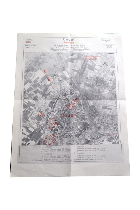
German air reconnaissance photograph of the town of Douai, in the Pas-de- Calais region of Northern France. The main factories and key infrastructure are highlighted in red on the photograph for targeting by Luftwaffe bomber crews. The town was heavily bombed in May 1940. During the late 1930s the Germans obtained extensive photographic intelligence of Western Europe from camera fitted to civil aircraft operated by the national airline Deutsche Luft Hansa and airship flights.
German reconnaissance photograph of the Pont D'Oye. This crossing of the River Oye was the last natural barrier to the beaches west of Gravelines and Dunkirk.
 During the late 1930s the Germans obtained extensive photographic intelligence of Western Europe from camera fitted to civil aircraft operated by the national airline Deutsche Luft Hansa and airship flights.
German reconnaissance photograph of the Pont D'Oye. This crossing of the River Oye was the last natural barrier to the beaches west of Gravelines and Dunkirk.

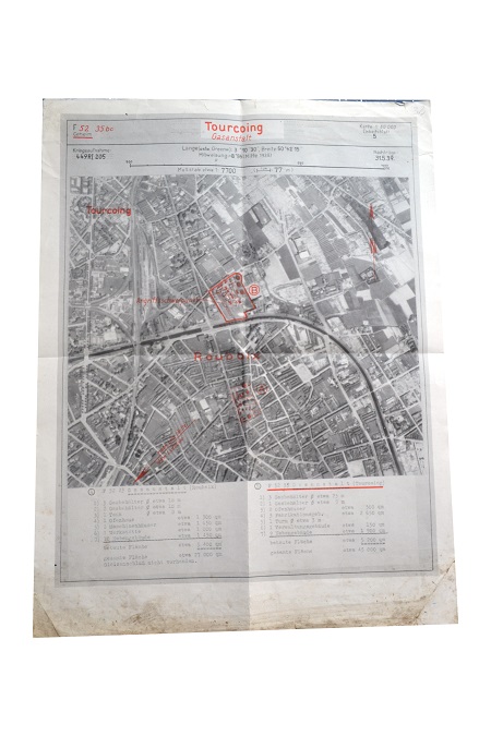
German air reconnaissance photograph of the industrial town of Tourcoing, in the Pas-de-Calais region, close to the Franco-Belgian border. The factory and power station facilities are clearly outlined.

